Track the Glider
The glider is underway!
Click on the link below to see what an ocean glider is and how it works:
See the Earth Science New Zealand page on Ocean Gliders here: Ocean Gliders
Additionally, you can take a look at the information on the Maui Ocean Heat Content Mission below the map.
The Maui Ocean Heat Content Mission
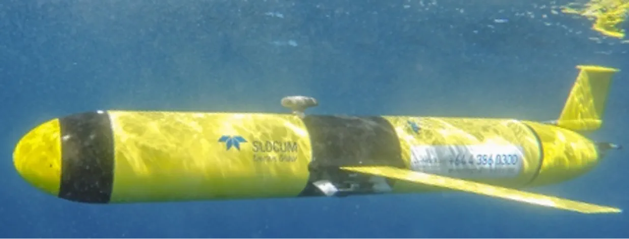
An Ocean Glider.
The ocean around Aotearoa New Zealand is warming faster than the average global rate. The result is affecting the weather and the coastal ocean in ways that will challenge the resilience of our society and economy.
What is it?
With the Maui Ocean Heat Content Mission we are embarking on a five-year mission to survey the storage of heat around our island nation. We will use ocean gliders - instruments that glide slowly underwater - to map changing seawater temperatures.
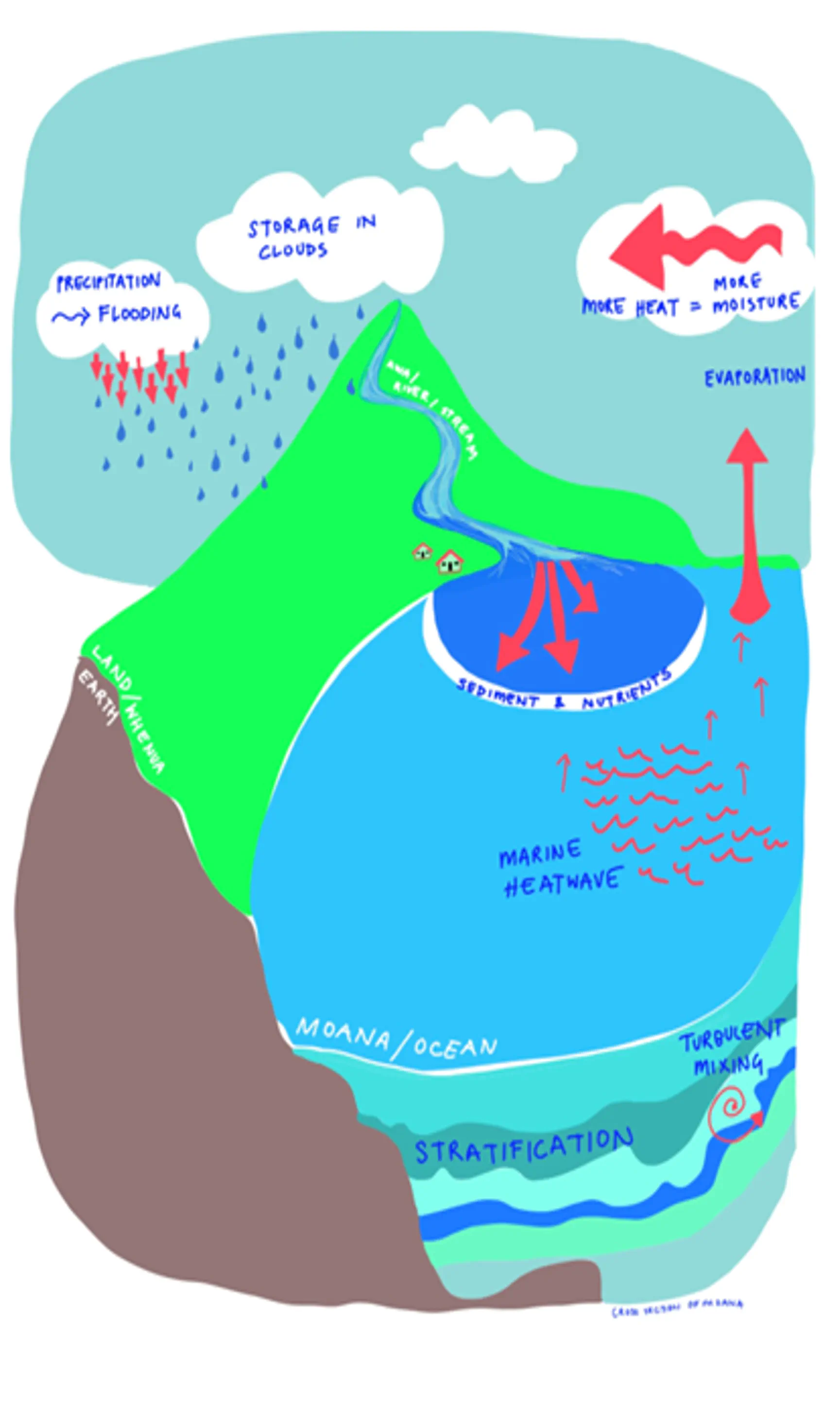
Connecting the deep ocean to what happens on land.
Why?
The survey will help prepare for future changes by understanding how temperatures in the deeper ocean connect to coastal systems which directly affect people and marine ecosystems.
Who are we?
We are a team of scientists, engineers, social researchers and artists supported by central government funding. We are based at the Universities of Auckland, Canterbury, and Otago and at Earth Sciences New Zealand, as well as colleagues in Australia.
What is an ocean glider?
An ocean glider is a 1.5 m long instrument package and works partly like a glider in the air. It has no propeller but unlike an airborne glider it can change its own buoyancy to go up and down in the ocean - as deep as one km. It then uses small wings to “fly” forward through the water. However, this all happens slowly - ocean gliders move at about one km/hr - much less than walking speed, collecting data as it goes. Every time the glider surfaces it sends these new data back to base via satellite.
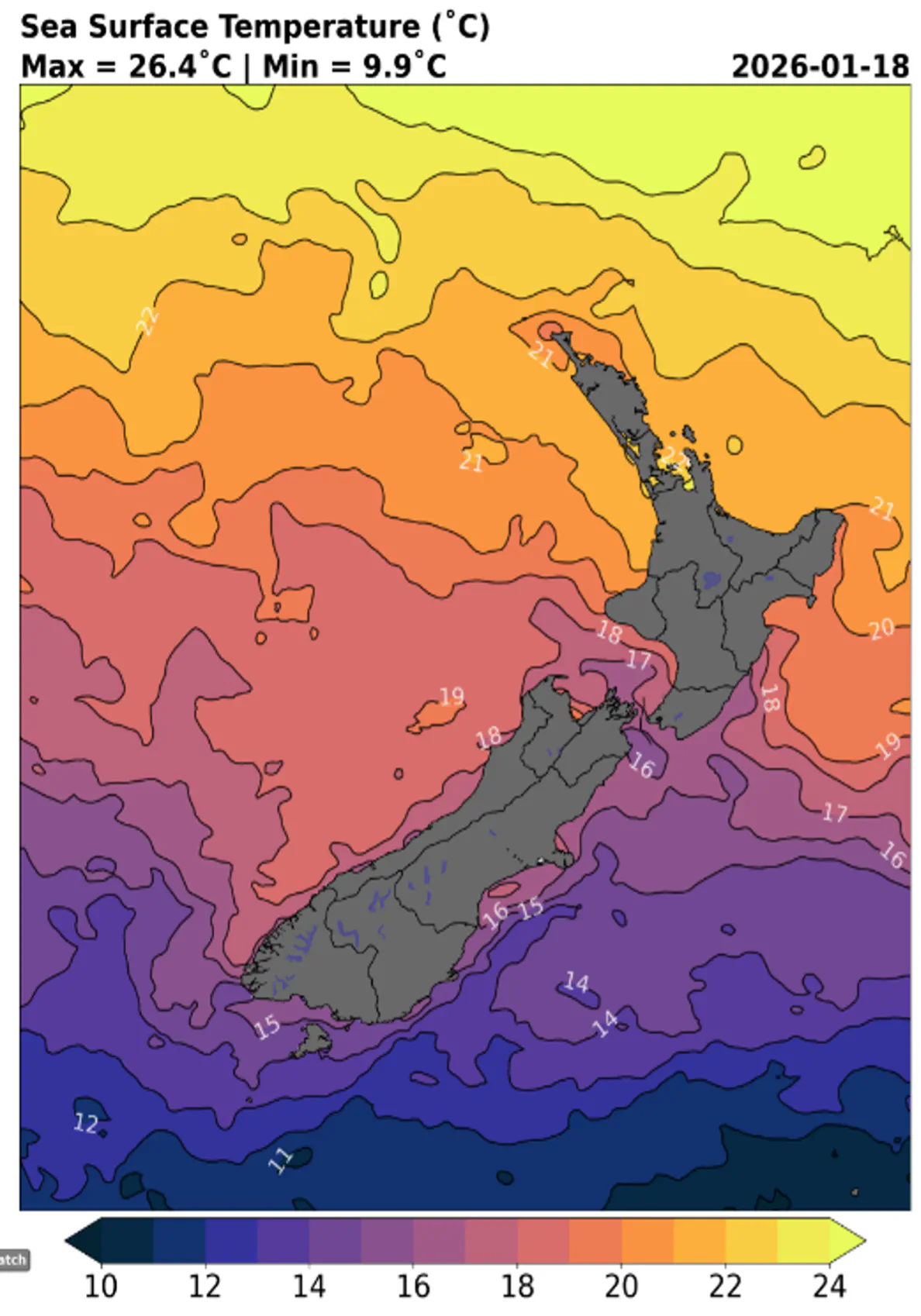
Satellite snapshot of surface temperature around NZ. This can only tell us indirectly about deeper temperatures.
What are we measuring?
During the Maui Ocean Heat Content Mission the ocean glider will measure the temperature and salinity of the seawater, as well as quantities like dissolved oxygen and amount of sunlight in the water. The glider doesn’t measure anything to do with the seabed; it doesn’t count fish; and it doesn’t take photos. It also moves so slowly that it is not a hazard to marine life or vessels.
Where will the mission go?
The overall mission will be to sample around the entire motu over the next 3-4 years in a series of stages - an ocean “heatscape”. Each segment will map ocean conditions offshore and together they will show areas of increased heat, as well as where colder water from the deep ocean comes closer to the coast.
What will happen to the data?
The data from the missions will be made openly available to anyone seeking to benefit from better understanding of the changing oceans around Aotearoa. More specifically the information will be made available to national, regional and local organizations so they have more evidence to make informed decisions about the marine environment now, and into the future.
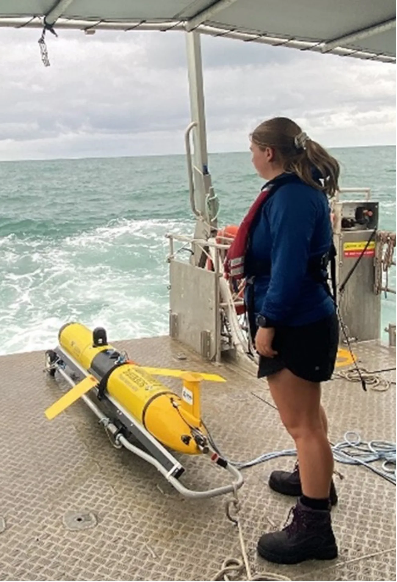
ESNZ’s Alice Overend about to deploy an ocean glider.
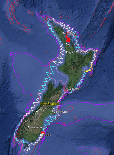
The entire ocean glider mission around the country is a series of zig-zag paths.